
Reality Capture 101
What is Reality Capture?
Reality Capture is a software solution that helps create 3D models from photographs or laser scans. Known as ‘photogrammetry’, it’s a technique that extracts three-dimensional measurements from two-dimensional data, so objects can be reconstructed and viewed in 3D environments. Photogrammetric scans serve to create endearing, high-resolution data assets that accurately document the shape, location and state of features of interest, and is particularly valuable in the context of new or exposed underground assets which are often impractical to survey once buried.
The adoption of reality capture technology in mapping underground infrastructure offers intriguing possibilities in the world of project management, particularly around documenting deliverables and asset installations. By pairing reality capture devices with survey-grade location data, projects can accurately record the position of underground assets before they are buried, and significantly reduce the risk associated with those utility locations in the future.
Why it should be used in capturing utility data?
Inaccurate and inconsistent documentation of subsurface utilities is a reoccurring problem in the construction industry affecting not only the end-users, but all stakeholders involved in designing, constructing, and maintaining pipes, cables, and other utilities hidden underground. The impact on projects can be seen in costly overruns and delays, not to mention the human cost due to injury from utility strikes. In 2020, the New Zealand Utilities Advisory Group, reported the occurrence of 12,861 strikes across New Zealand—over 30 per day, and in the US, there are between 500,000 and 800,000 incidents every year.
Reality capture is already used by the construction industry to document above-ground projects and work in progress; however, it has not been widely adopted for underground mapping.
By integrating reality capture into the construction workflow, we can capture accurate location information for future projects. This creates a visualization of the underground environment that can be instrumental in informing construction crews where risks exist.
There are two opportunities for image capturing during the construction workflow- during new installations and the excavation of existing infrastructure. The image capturing takes 5-10 minutes but the long-term value of the documentation to future projects is priceless. It could be the difference between a strike that could end someone’s life, or empowering workers to excavate with confidence of underground risk. The basic reality capture can be undertaken using an everyday smartphone and an app such as Pix4Dcatch. The images can be automatically uploaded to PIX4Dcloud for seamless processing or imported from the phone to the PIX4Dmatic desktop app, which combines surveys, refines outputs, and fixes any inferior scans. This creates a detailed 3D model of the surveyed utilities that can be integrated into any GIS platform, such as the Reveal Platform, and shared as a CAD/BIM/GIS file with projects working in the area to give an accurate visualization of the subsurface environment.
Industry Application
At Reveal, we use the Pix4D service desk as it has the most complete workflow and integration capabilities.
The below images show how 3D models are created using Pix4D catch on an everyday smartphone. These depict actions such as plotting a specific site, collecting photographs, and uploading them to be processed in Pix4D cloud to create a 3D photogrammetry model.
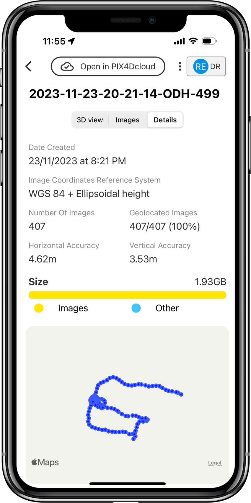
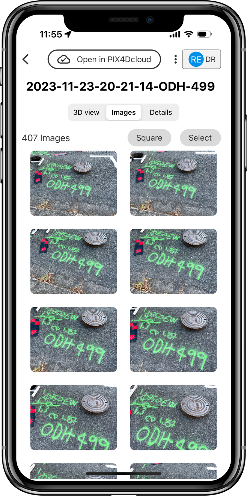
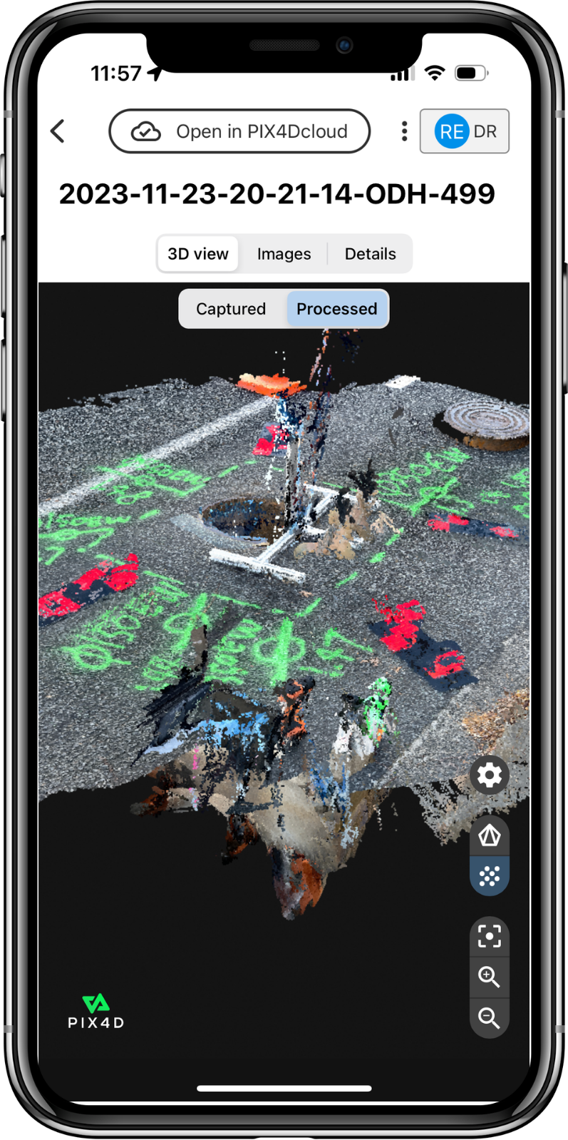
Figure 1 shows the processing phase in Pix4D cloud registering the points around the trench where images have been collected during excavation while the underground assets were exposed.

Figure 1: Inside Pix4D cloud
Once images have been processed a digital 3D model is created, as in Figure 2. The model is georeferenced using Ground Control Points (GCP) and image-captured landmarks before being imported into the Reveal Platform. This ensures that accurate as-builts are available from any projects starting in the area, setting a foundation for reliability throughout the project lifecycle.
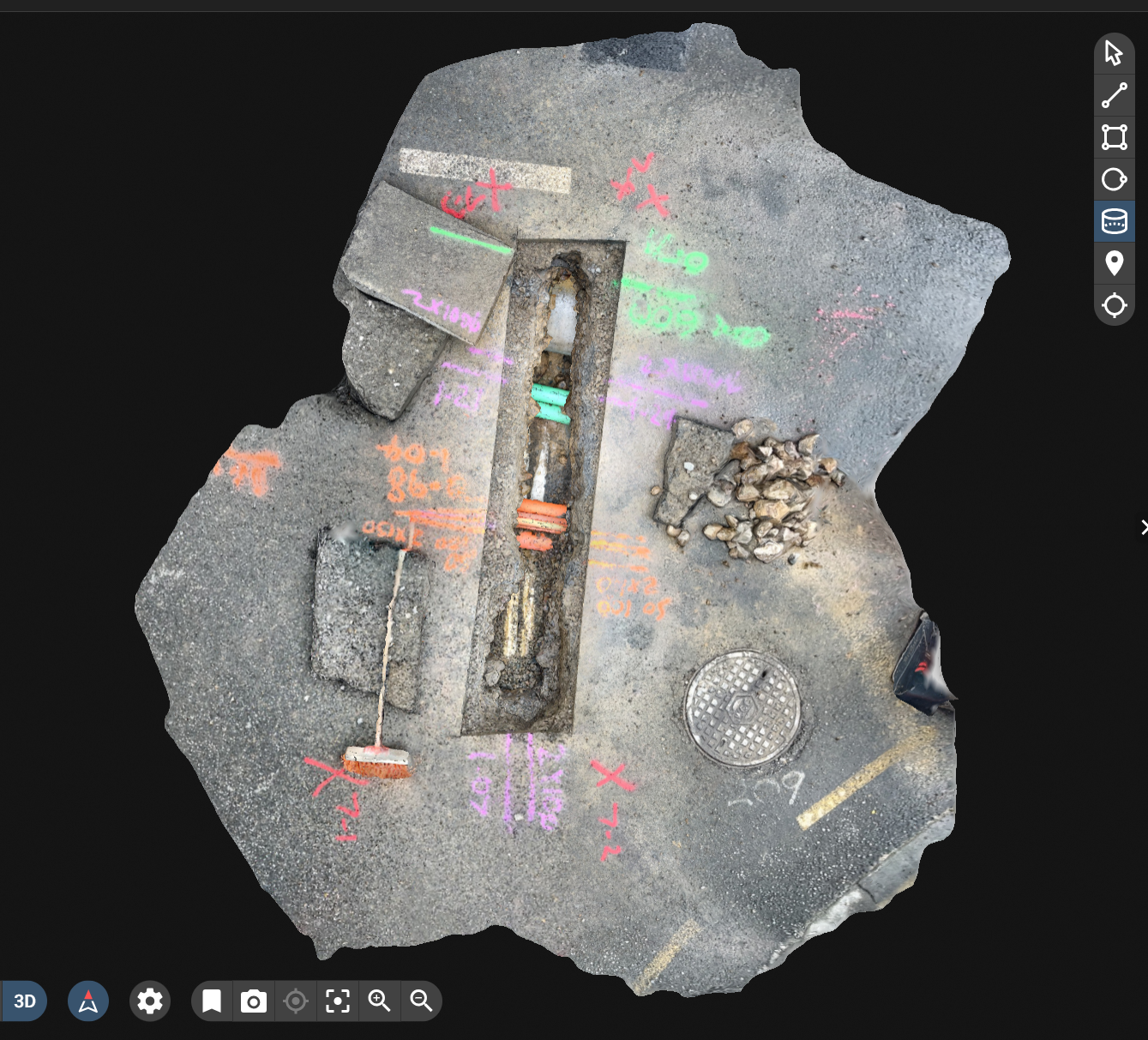
Figure 2: Photogrammetry 3D model created showing the exact location and depth of pipes
Integrating Reality Capture technology has been relatively slow within the infrastructure industry, appearing first in 2018. In 2021, two water utility companies in Denmark conducted a study into the effectiveness of smartphone-based reality capture for documenting utilities and reported a significant improvement in workflow management. By using reality capture, it removed most of the wait time for a scheduled surveyor to survey the exposed as-built utilities, thus resulting in time and cash savings for the entire construction project.
From the study, a hope for the future is that asset operators will adopt this practice so that 3D catch data can be shared and serve as an as-is documentation source for entire underground utility networks. For Reveal, reality capture provides additional source of visual evidence alongside GPR methods to support trustworthy utility location data. Every excavation is an opportunity to capture data and build an understanding of the underground without solely relying on GPR methods.
However, one of the issues surrounding the integration of this method into construction workflows is a lack of legislative incentives and an industry-ready platform that would integrate and store the 3D imagery for use. This is an issue we aim to solve with the Reveal platform and wish to spread the word encouraging the adoption of reality capture in aiding the development of a sustainable and coherent understanding of underground assets that can be utilized throughout the industry.
#LookDeeper #sue #Pix4D #RealityCapture #Innovation #UtilityMapping #CalltoAction #Infrastructure